Man and the Moor
Bodmin
Moor, a unique granite upland, covers 45,000 acres in total with most of the
land lying at a comparatively low height of 200 to a 230 meters. Its modest
height, combined with its southwesterly location, means that it is one of the
warmest and wettest uplands in Britain. Although a wild, uninhabited landscape
on its heights this was once not always so.
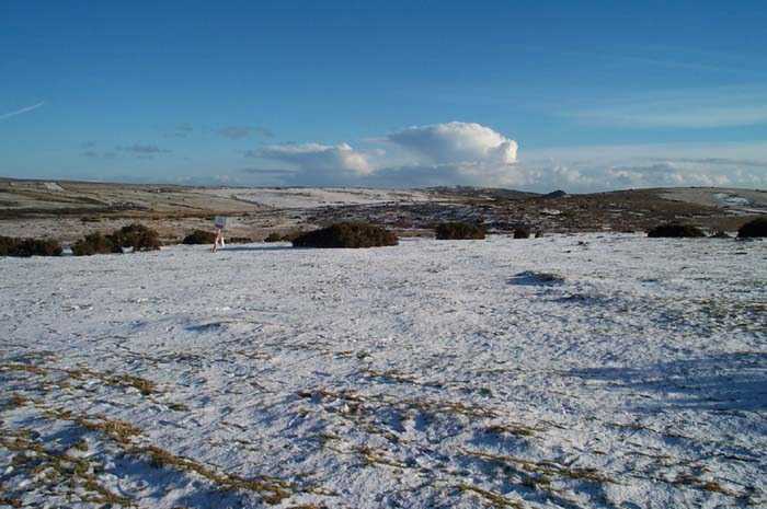
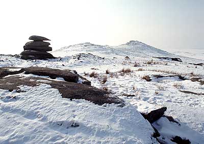
Roughtor has an Iron Age hill fort on the summit, a number of Bronze Age settlements, an ancient holy well and the ancient chapel of St Michael's. There are also hut circles, field systems, ceremonial monuments, menhirs, a stone circle and an embanked avenue all found in the area and mostly dating from 2000-1000 BC. Today the isolated tors and valleys are a perfect habitat for buzzard, raven, sparrow hawk and kestrel. The song of the skylark is a delight and on the grassy hills snipe, stonechats and wheatear thrive
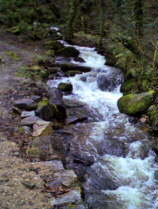
The rivers Fowey, Lynher, Inny and De Lank spring from the marshy upland of the moor. Although dangerous for walkers the marshes are a rich habitat for dragonflies, damselflies and the consequent birds that prey on them, like dipper and kingfisher. In the marshes we find rare plants like sundew and orchid as well as the more common ragged robin. Otters have returned here and in the valleys the mineshaft ruins provide an ideal home for bats.
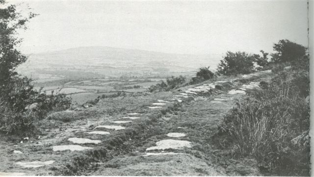
Mankind created a pattern of enclosures and settlements that are so much a part of today's landscape. The medieval period left its mark with a number of small buildings and structures associated with hill farming. St Michael's Chapel was first licensed in the 14th century but is possibly older and associated with a hermit who lived in a small building below the summit. He was also associated with the site of a Holy Well and the present day remains of a cross. Then many of the farmsteads on remote hills were abandoned. The ruins of these homes and barns can still be seen and the ancient paths and lanes that led from the hills to the surrounding valleys. Farmhouses still occupied today were most probably first settled long before the arrival of William the Conqueror
In more recent times, granite was surface quarried and numerous part worked millstones are now evident. There were also granite quarries & china clay pits. Stone from the De Lank Quarry was used for many famous landmarks. The Eddystone Lighthouse 1882: Tower Bridge 1890; & Beachy Head Lighthouse in 1900.
Some
others also constructed from Bodmin Moor stone were:-
Calcutta Docks, Bombay
docks, Devonport dockyard, Copenhagen docks, Liverpool docks, Southampton docks,
Singapore docks, the Mole at Gibraltar, London Bridge,
Westminster Bridge, The Embankment, Portland Breakwater, The London Stock
Exchange, New Scotland Yard, Waterloo Station, The British Museum, The Tate
Gallery, Congress House, Milton
Keynes New Town, Newcastle-upon-Tyne
Civic Centre, The Royal Academy
courtyard in Piccadilly, Marks & Spencer’s store in Brussels, , , , , and
Woolworth’s in Oxford Street.
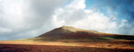
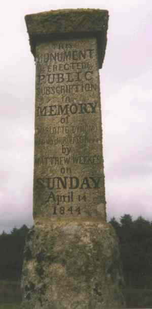
The twin heights of Roughtor and Brown Willy [Cornish Bron Wennyly = Swallows' Hill] have always had the power to attract. Wide open spaces tend to enforce mans feeling of insignificance in the scheme of things. Large groups of people are not often seen on the high moor. However, a gathering of some 10,000 teetotalers held a meeting here in 1844. Perhaps they felt nearer to their God way up on the heights?
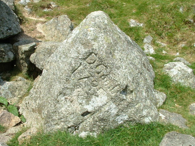
In the past the usual walkers on the moor were the labourers and dairy maids of the working farms scattered about. One such couple was a local dairymaid, Charlotte Dymond, and her young man, Mathew Weeks. They both worked at the same farm and had been courting each other for some time. One Sunday in April, in the same year as the teetotalers meeting, Charlotte walked out with him across the moor, intending it was said to break up with Mathew. She was later found with her throat cut at Roughtor Ford and the evidence pointed to her spurned lover. He confessed to the crime of murder and paid the ultimate penalty when he was hung at Bodmin Jail.
Ever
since that time, especially on the anniversary of her death, Charlotte has been
seen walking alone in the area, clad in a white gown, a red shawl and a silk
bonnet tied with a red ribbon.
Sentries of the Old Volunteers Unit stationed in Roughtor were very reluctant to
stand duty there, so convinced were they of her ghostly presence. A memorial
stone marks the site of her murder and the story of poor Charlotte's
demise has been lyrically immortalized in
"The Ballad of Charlotte Dymond" by Cornish poet Charles Causley.
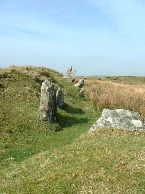
Beneath these twin Tors on Cardinham Moor can be seen a stone row named Colvannick. Compared with other stone rows on Bodmin Moor this one is made up of giant stones. The southern one was about 6ft high when upright. In the eastern sector at Craddock Moor they struggle to be seen above the grass. Here on a ridge with views to the east and west it was built to be seen. At evening the view to the west is of the shining waters off Padstow.
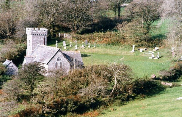
A tour of the some of the villages on the moor will perhaps take you by surprise, as they are often not what you would expect. They are quite picturesque and are set in gentle dips in the upland. Thus sheltered from the worst of the wind and weather trees grow and provide further shelter. Most have a church.

St
Breward was once known as Simonward, they say after one Simon Ward the
brewer to King Arthur's Court! The original church was Norman but the building
today is mainly 15th century with Victorian restoration. The tower at 750 ft above sea
level is probably the highest in Cornwall. A
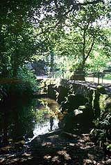
picturesque granite clapper bridge straddles the De Lank River between Blisland
and St Breward and carries the moorland road between the two villages.
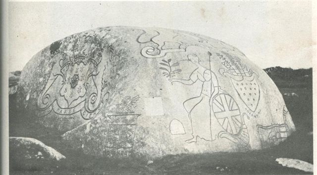
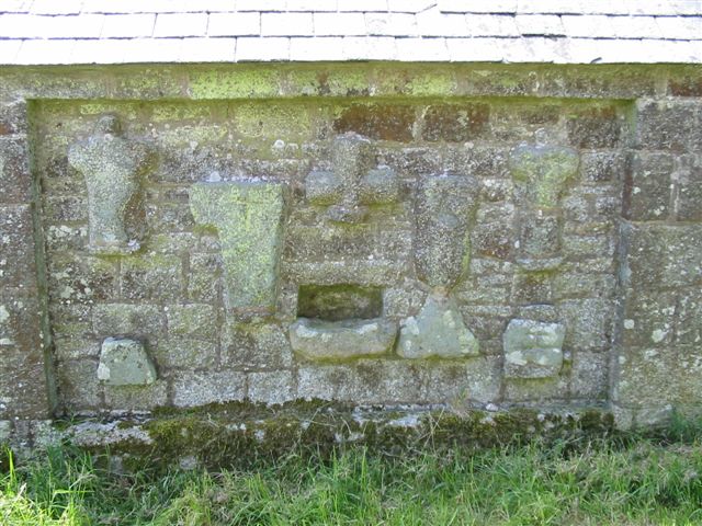
Blisland is one of the few villages in Cornwall with a traditional village green, more usually associated with rural villages in the heart of England. It has a Norman Church with later additions but with much of the medieval woodwork remaining, including the barrel roof, due to a skilled restoration in the 19th century. East of the village is the Jubilee Rock, a giant volcanic rock, perhaps the oldest on the moor, some ten foot high and nearly twenty-five feet across.
Lieutenant
John Rogers of Pendrift carved this stone with various coats of arms and
insignia to commemorate the 50th anniversary of the coronation
of George III that fell on 25 Oct. 1810.
It took him over 12 months and as well as the Royal Coat of Arms there were also
those of the Duke of Cornwall, Sir A. O. Molesworth, baronet and Viscount
Falmouth and a figure of Britannia.
The carvings were then painted in appropriate colours and 200 years later faint
lines could still be traced on the rock.

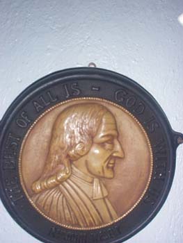
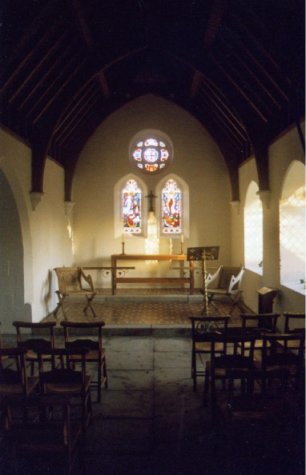
The church at Altarnun also with a high tower is known as 'The Cathedral of the Moor'. Sixteenth century craftsmen signed their names on the bench ends in the church. They are carved with local scenes. Close by is the holy well of St Nonna. Adjacent to what was once the Ring O' Bells Inn is the old Methodist Chapel. Built at the end of the 18th century with its unusual granite steps leading to the floor above. One day the floor of the chapel collapsed during morning worship, and the proprietor of the Ring O' Bells, hearing the commotion, rushed out and shouted at them 'So the Devil got 'ee after all!'
Over the door is a carved slate head of John Wesley, carved in 1836 by gifted local boy Nevil Northey Burnard. He was born in Altarnun in 1818 and his work includes the statue to Richard Lander the explorer. This is high on a column at the top of Lemon Street in Truro. Nevil came from a long line of builders and sculptors and more of his work can be seen on gravestones in the churchyard. He went on to achieve national fame by sculpting the head of the Prince of Wales, later Edward VII. Many commissions followed, but after the death of his young daughter, he returned to the West Country and became a drifter, dying a pauper's death in Redruth Workhouse in 1878. A plaque to his memory is sited on the house alongside the chapel which once was the inn.
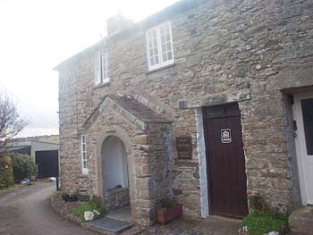
Trewint is village high on the moor and in 1743 Digory Isbell, a journeyman stonemason, and his wife Elisabeth lived in a small granite cottage at the far end of narrow Duck Street. In the summer of that year, when Digory was away working, two of John Wesley's agents arrived tired and hungry. They knocked at the cottage door asking for refreshment and were made welcome by Elisabeth. On leaving they knelt and prayed 'without a book'. A year later on April 2 1744 John Wesley himself was entertained in the cottage and later recorded in his Journal..........
"I preached at five and rode towards Launceston. The hills were covered with snow, as in the depths of winter. About two we came to Trewint, wet and weary enough, having been battered by rain and hail for some hours. I preached in the evening to many more than the house would contain,
One evening a few months later, Digory Isbell read in his bible of the Shunamite woman who built a Prophet's Chamber for a man of God. He saw this as a divine command and set about building a two-roomed extension to his home. John Wesley and his preachers would use this house for meetings whenever they were in the district. A flourishing Methodist Society was formed but as other larger chapels were opened the rooms fell into disuse. Digory Isbell died in 1795,and Elizabeth survived him, blind, deaf and bed ridden until 1805. Both found comfort in the hymns of Charles Wesley and Elizabeth often quoted from the one below.
I long to behold him array'd
With glory and light from above;
The King in his beauty display'd,
His beauty of holiest love:
I languish and sigh to be there,
Where Jesus has fixt his abode:
O when shall we meet in the air,
And fly to the mountain of God?
After the death of the Isbells the beginning of a legend can be discerned in the tradition that one could hear the bells of heaven ring by the simple expedient of running twelve times round the Isbell tomb and then putting a finger in each ear.
Passing over the main A30 road, which more or less separates the moor onto two halves, we find several places associated with the Arthurian legend.
Arthur's Bed
is near Trewortha Tor, and is an almost man shaped depression worn
into the stone by years of harsh moorland weathering
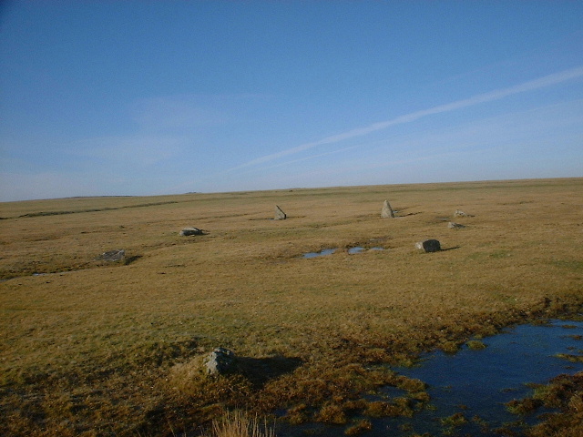
King Arthur’s Hall
is stone circle where the imagination can take a
rest as the scene is re-created for you. If you have
seen the film 'Excalibur' and remember the scene where the knights and druid
priests hold a ceremony on a hill top henge – then this is such a site, with
the "Hall" set a little lower in a shallow bowl.
When the sun shines, like it only can in Cornwall, and the reeds in the centre are
all topped with cottony blossom, then you will hear the breeze whistling through
the marsh and overhead the skylarks climbing ever higher in their ascending
song. Everything is perfect and there descends an air of serenity as you feel at
peace with all the ghosts of the past.
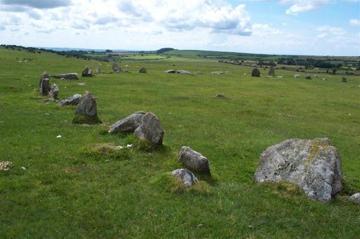
King Arthur's Downs is set a little apart to the east of King Arthur's Hall. The beauty of the wide expanse of moor is set with a destroyed double circle Only one or two stones remains upright and it is not easy to work out which stones belong to which circle.
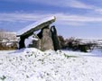

Trethevy Quoit was once called King Arthur's Quoit but is now known locally as “The Giant's House” In 1605 it was "called in Latin Casus gigantis, a little howse raised of mightie stones". It is one of Cornwall’s finest and most impressive dolmens. The capstone is 12ft long and, in its half-fallen state, 15ft high. There is also a natural hole piercing its highest point. The function of this port-hole is still a mystery: experts speculate that it was used for astronomical observations. It has six uprights -originally seven - each averaging about 10 ft. A strange doorway cut out of the entrance stone may have been for the passage of bodies. Curiously, the sloping angle of the top of this hole is reminiscent of many free-standing stones
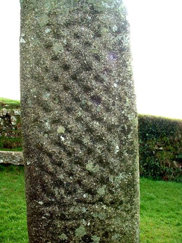
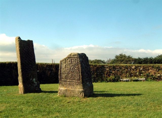
On the road from Redgate to Minions is an enclosure. A plaque set in the wall reads:
" 'King Doniert's Stone' in Cornish 'Men Myghtern Doniert'. These two granite cross bases are decorated in the late Ninth Century style and probably date from that time.
The shorter stone carries a Latin inscription"Doniert progant Pro Anima" - "Doniert ordered [this cross] for [the good of] his soul". Doniert was probably Durngarth, King of Cornwall who was drowned in AD 875. The two stones have rectangular sockets on their top and probably carried wooden crosses"
Durngarth tragic drowning, possibly in the nearby River Fowey, was recorded in the “Annales Cambriae.”
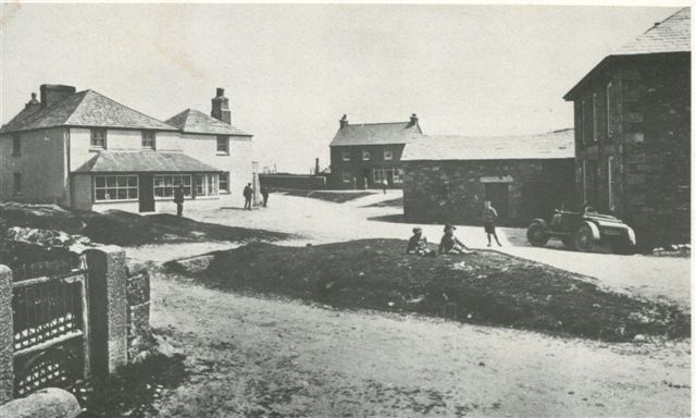
Minions Village c 1890.
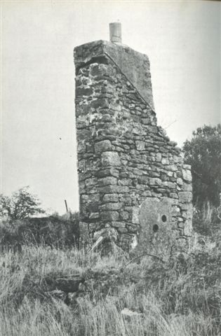
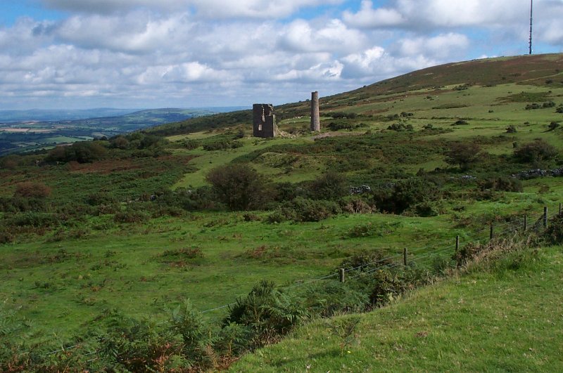
The evidence of tin stream works are found all across the Moor, where valleys were dug for the tin gravels and leats built to bring water for the separation processes. In the 19th century the tin and copper mining became a powerful industry and with the granite and china clay quarrying created communities where the employment was to be found. Villages such as Minions prospered greatly during the mid 1800's when Captain Jack Clymo discovered a rich copper lode By 1863 over 4000 men, women and children were employed in the twenty or so mines surrounding Caradon. There are still remains of the engine houses standing, one of which has been turned into a heritage centre.
When, as well as the copper, tin and a little gold was also discovered share prices rocketed. Caradon mine shares rapidly went from 1s 6d (7p) to £64 with good dividends. There were also of course many sharp deals and highly speculative investments that inevitably turned sour. The Liskeard-Caradon railway passed within a few hundred yards of the workers cottages.
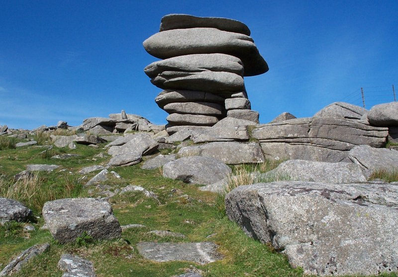
Close to the village of Minions is a famous
local landmark known as the Cheesewring This was
at risk as the quarry workings at its base crept closer and closer.
The saints were setting up TOO many preaching crosses, taking TOO many wells as holy, enjoying TOO much attention and claiming TOO many tithes from the hard won harvest of the land and sea. St Tue, [no pun intended, I’m sure] who was a particularly small saint, heard the giants arguing about the best way to rid Cornwall of the saints. St Teu decided to challenge Uther, the leader of the giants and a particularly large and strong giant, to a trial of strength. They both agreed the terms that if the giants won the saints would leave Cornwall forever, but if the saints won the giants would convert to Christianity.
Twelve large rocks were gathered for the contest. Uther picked up the smallest rock and hurled it onto the summit of Stowes Hill. St Tue picked up a larger rock, and managed to throw it exactly the same distance, landing on the smaller first rock. So the contest continued, larger rocks piling on smaller ones, until Uther failed with the last rock and it rolled back down the hill. St Tue muttered a prayer to all the saints in Heaven to give him strength to top the pile and so defeat the giants. He picked up the last stone and hurled it high to land on the top of the heap. Thus the saints won and the giants under Uther abandoned their sinful ways. The Cheesewring remains to this day as a reminder of the struggle between the Giants and the Saints in Cornwall.

A well-known character that made his home near the Cheesewring in earlier times was one Daniel Gumb. Born in the Tamar Valley in April 1703 he moved up onto the moor to be where his work was. He was a stonecutter and as well as stone for building purposes he also cut gravestones, some of which can still be be found in local churchyards. What we see now of his home is only a small part. It was once sited on the south-facing slope of Stowes Hill or what is now the Cheesewring Quarry. The large slab roof was originally 30ft by 10 ft and Daniel tunneled under it putting other slabs in to support the weight until he had three rooms. Sitting on the roof of his house Daniel studied the stars by night and solved mathematical problems by day. The carving of Euclid’s theorem on the roof can also be found on other slabs of granite east of the old railway line into the quarry.
In this
primitive house he brought up at least 9 children, it is thought that he had 13
but some died early. The date carved on the stone beside the house "D GUMB
1735" is said to be the date of his third marriage and was part of the door post
for the house.
When the Cheesewring quarry was started in the mid 1800s the home was broken up,
Gumb had died in 1773 and many of his offspring had emigrated to the Americas.
What remains now is only a small part, possibly placed in amongst the finger
dumps of the quarry as a shelter to use during blasting.
.
The railway at the Cheesewring opened in 1844 and his was used to transport the silver-grey granite to Liskeard and Looe for export; the old track is still visible in parts.
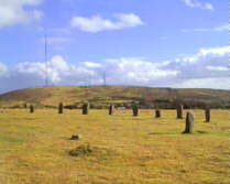
Hurlers Long Tom Minions Mine
Not far from the Cheesewring, you find a track that takes you to the Hurlers. The historian William Camden wrote in 1610:
“The neighbouring inhabitants terme them Hurlers, as being by devout and godly error perswaded that they had been men sometime transformed into stones, for profaning the Lord's Day with hurling the ball: but in truth show a note of such victory, or else are so set, for landmarks and boundaries"
According to legend, it is difficult to count the number of the Hurlers at
Minions, but should you do so correctly, a misfortune will befall you. Surrounded by deserted mines and other
industrial wreckage these three stone circles are built close together and all
in a line. They vary in size from 105 feet to 135 feet across. The largest is
the central circle and this seems to be the focus of the site due to its size
and the fact that it has a central stone. Built in a high moorland pass, between
the slopes of Stowe's Hill to the north and Caradon hill to the south, the site
is strategically placed between the tributaries of the River Fowey to the west
and the River Lynher, which feeds the Tamar, to the east.
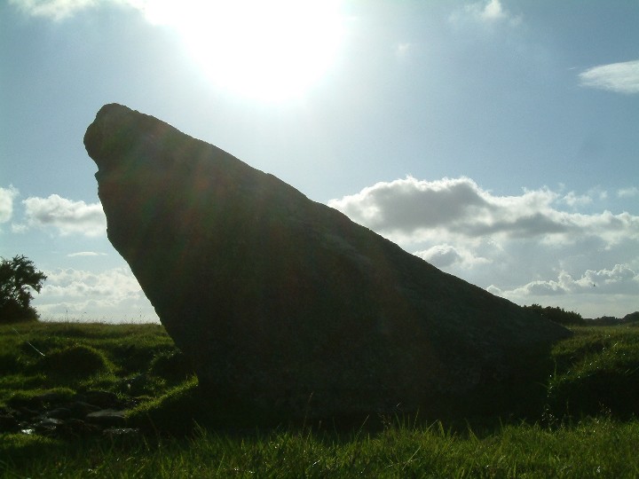
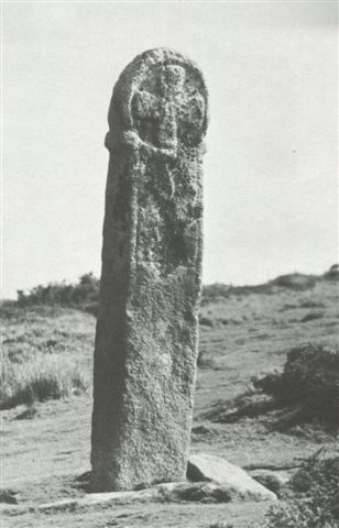
A little way along beside the road from the Hurlers is Long Tom or the Longstone, a Christianised Menhir, having had a wheel cross carved on the top

At the edge of the granite the land falls away,
down to the slate. The rivers fall away
too and at Golitha Falls are extravagant
ferns, lichens and mosses and bluebells in springtime.
You might also call to mind, when driving between Minions [at 300 ft on
granite] & Upton Cross [at 175
on slate], that you have to change gear or put on the breaks due to a
geological event that occurred around 290 million years ago; that's when the hills
between were formed
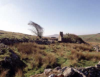
Not far from Bolventor is a little lane that leads off to the south. At the end of this is the enigmatic hamlet and church of Temple. It originally came into being in the 12th century when the Knights Templar built the church and possibly some ancillary dwellings as a refuge for pilgrims who were passing through this wild stretch of country on their way to the Holy Land.
Travellers from Ireland often avoided the perils of the Land's End by disembarking at Padstow. They would then sail up-river, perhaps as far as Wadebridge, and then journey overland to the Fowey river. They would finally disembark from the port of Fowey itself, then the busiest harbour on the south coast. The Knights Templar were harried, tortured, and suppressed 700 years ago on trumped up charges of pagan ritual and satanistic practices. Their church of St. Catherine of Alexandria at Temple, sited on their ancient abbey settlement, was finally suppressed in 1312 and taken over by the Knights Hospitallers. However, it still remained outside the authority of the bishop. John Norden the mapmaker, who visited in 1584 described it as..........
"a lawless church where manie badd marriages are consumated and where are wonte to be buried such as wrowght violent death on themselves"
Before an act was passed in 1753 declaring such marriages illegal, runaway couples eloped across the moor. Unfortunately the old registers were lost which could have made interesting reading. With the decline in pilgrim traffic and later as a result of the act Temple lost its passing congregation and presumably a fruitful source of income and it soon fell into disuse. No services were held there for more than a century and the building succumbed to the wind and the weather A tramp, who was sheltering inside, was killed when the remains of the roof fell in; surely he must have offended God gravely to have brought His wrath down on him so!. Another visitor in 1769 remarked that ....
" Temple is a deserted village, the only one I have ever seen. Some years ago not a single person lived in the township......only one little farmstead is now inhabited and elsewhere only the ruins of half a dozen or more remain; the body of the church is down and naught but the chancel remains."
In Illustrated Itinerary of Cornwall from England in the Nineteenth Century – C Redding (1842):-there is this description.
“We reached Jamaica Inn at night-fall, in a drizzling south-west rain, and
on foot, having left the mail to examine the Four-Hole Stone which stands to the
roadside, about a mile from the Inn, on a desert heath, called Temple Moor;
truly, ‘a waste, howling wilderness.’………it contains only three
miserable huts, and the remnant of a dilapidated church.”
It was rebuilt in 1883 along the original foundations using some of the stones
that were still to be found on the site. On many of these stones were the
original carvings and
some are still visible on the little sexton's building in the churchyard. This
may have been built on the site of the holy well as a channel of water
passes through its interior and out of the wall into a basin.
It was said the last two Temple men were hung for sheep stealing in the 1700's and then there were no men left in the village. This must have been rectified by new residents coming in as even here they lost a son of the village in the 'great war to end all wars'. The Memorial bears witness to one....................
"Jack Pomeroy, killed in France,19 July
Although today time seems to have passed this place by it is very much haunted by the spirits of the past. Inside the church are many references to its Templar connections. Cryptic symbols are contained within its stained-glass windows and carved statues. It was said that here the cult of the Rose was once practiced on this site and the sanctity of motherhood itself was venerated. Women, married or single, could attend their laying-in in the little mission hospice and their condition was honored as a gift from God. Some say this was too close to the old pagan goddess worship and it led to the discrediting and ultimate persecution of the order of the Templar Knights by the established church. The signs of the Rose and the Cross are ever present, even to the stones in the graveyard outside and on the little well building. Some of those who searched for the Holy Grail believed it to be a metaphor for womankind and her power to bear children. In most portrayals of the Holy Grail Story the precious cup or chalice is borne by a maiden, the significance of which might be that "Sant Graal" could also mean Holy Blood. The doctrine of the old pagan beliefs with its Goddess worship was repeated in the story of the Virgin birth. The question is were the Templars practicing the old religion or the new? Whichever it was the church believed they had become too powerful and they would have to go. Below is Arthur Rackham's illustration of the Grail maiden from Alfred Pollard's 1917 Romance of King Arthur and his Knights of the Round Table.
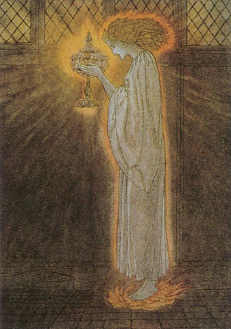
If you linger awhile in this holy enclosure the air is filled with the sound of silence and the world seems far away. The whispering wind lulls the leaves into life and then all goes still and quiet again but you will not feel alone here. The perception of right and wrong changes with time and in1777, when the little sanctuary at Temple was a virtual ruin, a young woman called Edith Gilpin of Temple gave birth to an illegitimate child. For her 'sin' she was ordered, by the great and good of the Bishops Court, to go bareheaded and barefooted to morning service in Blisland and Cardinham churches to make a public confession of her guilt. Wearing only a white sheet, she endured this ritual on successive Sundays until the clergy had decided she was purged. This description of her appearance is not unlike the young woman in the illustration above.
Has Edith forgiven them who presumed to judge her or does she still haunt the Moor?
+++++++++++++++++++++++++++++++
With thanks to the many photographers and researchers who give freely to the world wide web of their time and energy in the interest of furthering knowledge and to those who allow their work to be downloaded for free, provided there is no commercial gain among whom are the following
-0-0-
Trewint Cottage & Wesley's Head: Steve Beazley http://www.cornwall.netfirms.com/photos.html
Temple Church http://www.temple.org.uk
Cheesewring
and Minions:
http://www.westcountryviews.co.uk
Cheesewring
in snow:
http://www.imageclick.co.uk
King Arthur’s Bed: Snow on the Moor & Ruin: http://www.atlantic-highway.co.uk
Colvannick Stone Row ,Cardinham Moor: www.themodernantiquarian.com/home/
Roughtor
:
www.bodminmoor.co.uk/villages.html
Also
see the Charlotte
Diamond page with
appraisal of the trial and their
conclusions:
http://www.parmaq.com/truecrime/CharlotteDymond.htm